Welcome to St Andrews
Whether you are with us for a short visit, or longer, read about the history of the town, the streets, castle, cathedral and quads of the 600 year old University and, of course, the home of golf.

The Guide
This 120 page guide informs the reader of the town, the four main streets, the medieval University, the ruins of the castle and the cathedral and of course, the home of golf.
The ebook or paperback can be ordered from Amazon.co.uk and the paperback is also available in Waterstones bookshop in Market St, St Andrews.
The Amazon page is at https://qrco.de/bd7a05 or scan the QR code below.

The Highlights
The guide gives information about the following:
- The beginnings of the town
- The start of golf
- History of the castle
- History of the cathedral
- The quads and buildings of the University.
- Walks including the West Sands, the East Sands and the Lade Braes
- Cycle routes
- Local villages and parks such as Crail, Anstruther and Pittenweem, Tentsmuir, Forest and Craigtoun Park
- Ancient sites such as Dunino.
- Public Toilets
- Churches
The author
Ishbel lives in St Andrews and is a recently retired University academic. She wrote the book for her daughter when she became a student at the University. The book is still growing in size and the author is currently working on version six, courtesy of friends who ask her to include more information.
She has a children’s book due out this summer called the “Dragon Who Invented Golf” and she is working on a booklet about slavery in Dundee having worked on that panel on the Dundee Tapestry.
Apart from continuing some of her academic writing, she is keen on gardening, needlework, walking her, or other people’s, dogs and she spends much time in local orchestras and musical groups. She recently took up the clarsach but is still playing it like the woodwind player she really is, that is, badly.
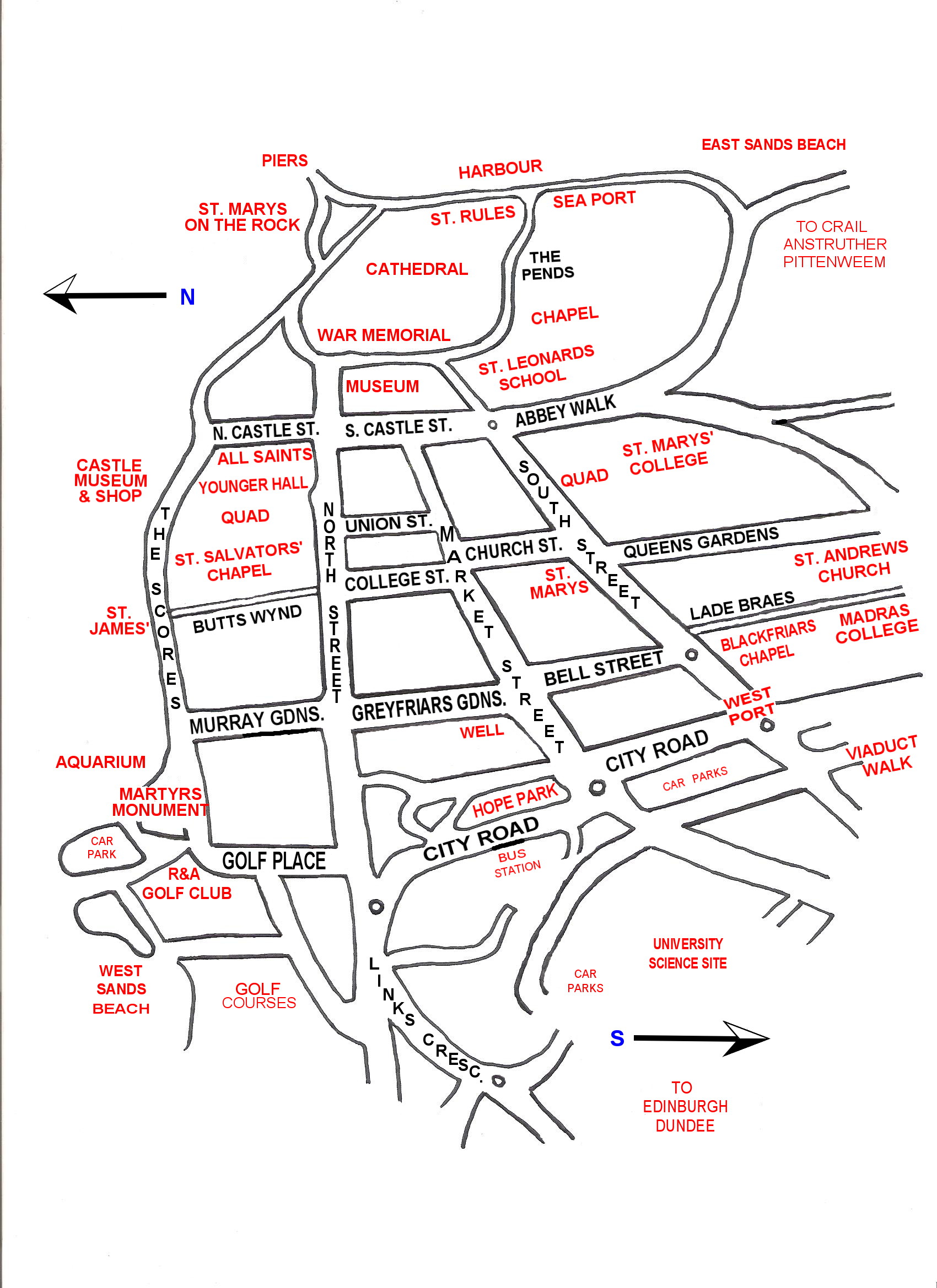
Some maps, images and snippets below
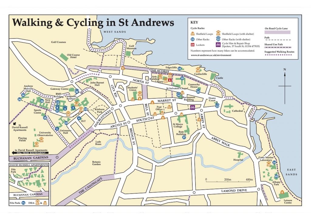
Cycle Map courtesy of the University of St Andrews
Selected images
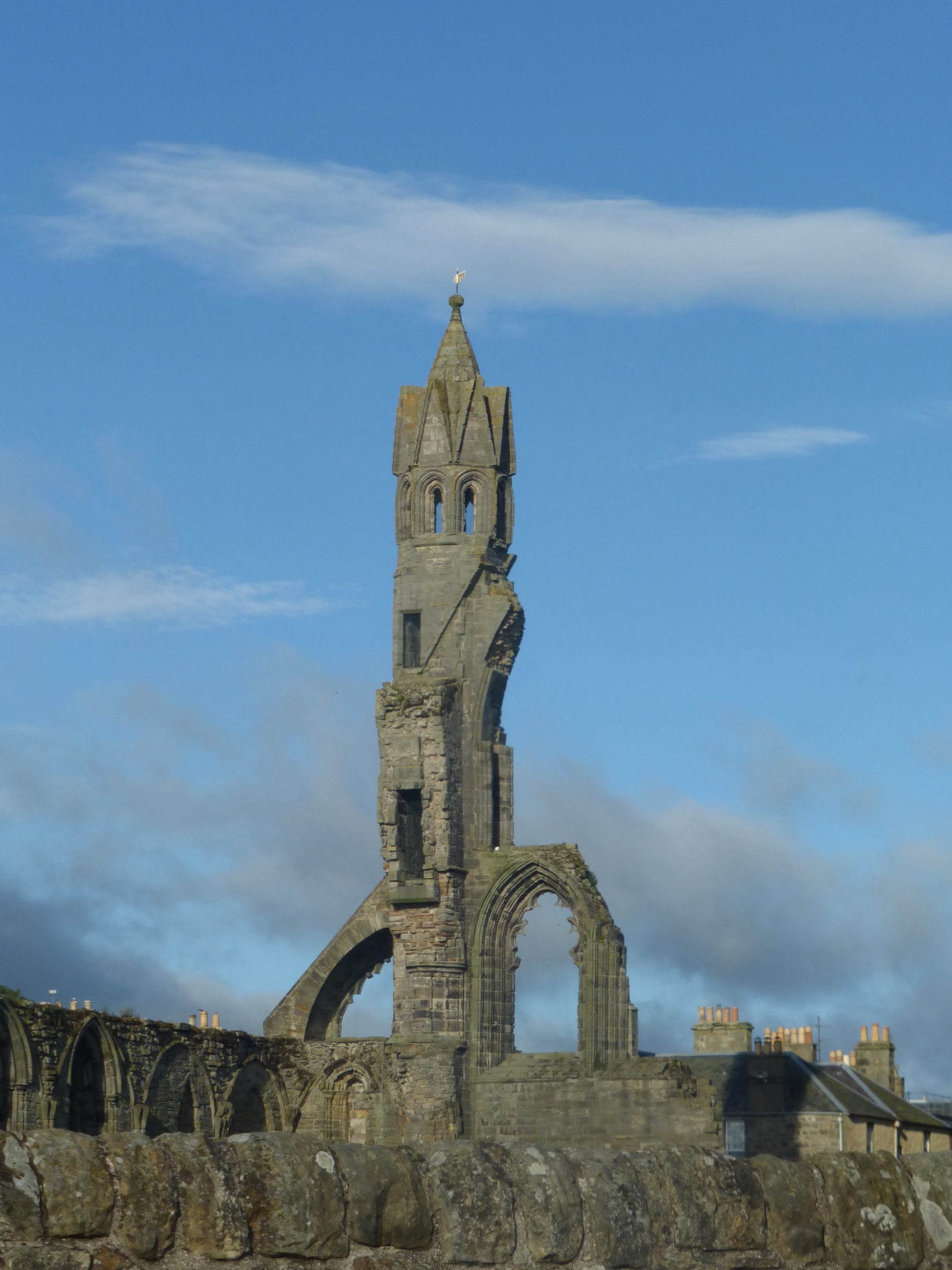
The Cathedral was founded in 1140 and consecrated in 1318. Robert the Bruce filled the Cathedral with cloths of gold and silver taken from the English army at the Battle of Bannockburn, four years earlier. At 110m long and 50m wide the main church is still the biggest ever built in Scotland. Strong winds took down some walls in the 16th Century and by the 1660s the townsfolk were reusing the stones to build their houses and the main pier.
The site also includes the Priory with its large quadrangle and the Church of St Rule, the rectangular tower dating to the 11th Century. St Rule allegedly brought the bones of St Andrews to the site. A fourth church on the site was the Holy Trinity Church for the local townsfolk. This was moved into South St where it now stands.
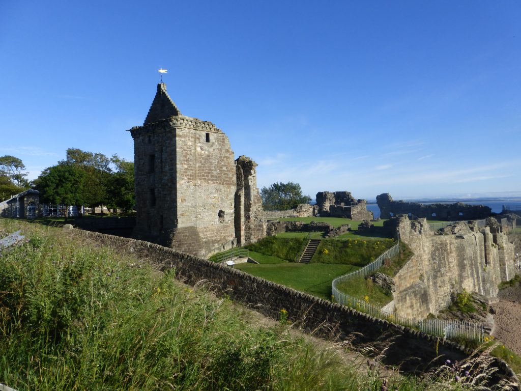
The Castle has been through many transitions and occupied by many forces. Bombarded or invaded by Scots, English, French (on behalf of Mary Queen of Scots), and Catholics or Protestants, the Castle has been more fought against than most. Bishop Beaton watched the Protestant martyr George Wishart die from the window above the emblem. Stones in the road show where Wishart was burnt. Weeks later, Beaton’s body was hung out the same window.
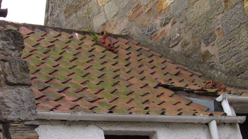
One of the fisher houses in South Castle St has a ceramic cat and rat on the roof tiles. The owners placed them there to indicate the original name of the street, which was Ratten Row. Street names were changed throughout the 18th and 19th century when slum houses were cleared. Names such as Union St, rather than Foul Waste, indicate when a street name was changed and the area cleared.
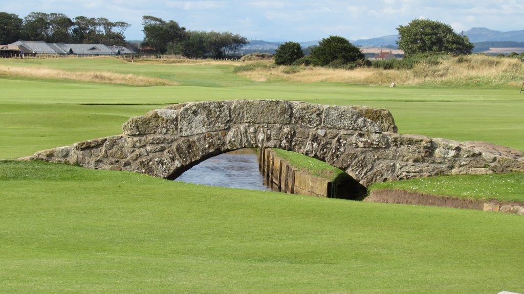
Often called the Swilken Bridge, this is actually one of three bridges over the Swilken Burn and was always known as the PackHorse Bridge. It is estimated to be about 700 years old and it was Old Tom Morris who banked up earth around it to protect it. Only about the top third is visible now. It is often used for Golf Tournament winners when posing with their trophies.
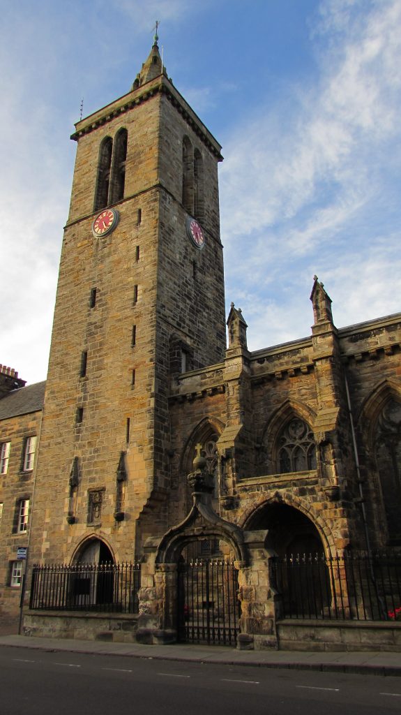
St Salvator’s Chapel in North St is the University chapel built between 1450 and 1485. It houses the remains of Bishop Kennedy who started the main building of the University in what is now St Salvator’s Quad behind the chapel.
The chapel was in ruins at the end of the Victorian era and at the turn of the 20th Century money was raised to seal and renew the roof and woodwork within the chapel. It is used weekly by University staff and students on Sundays at 11am during term time. This is followed by the pier walk when red gowned students walk to and from the main pier. The Chapel is in great demand for other services such as for graduation, marriages and funeral rites of celebration.
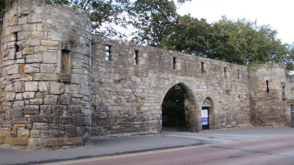
The Cathedral precinct wall took 150 years to build and was meat to protect the priests and brothers of the Priory from external attacks or disease. The Teinds gate, down Abbey Walk, is where local farmers brought their teinds, rents or portions of their produce, to their landowners. The Cathedral owned land to the west of St Andrews and the Priory owned land to the south and east.
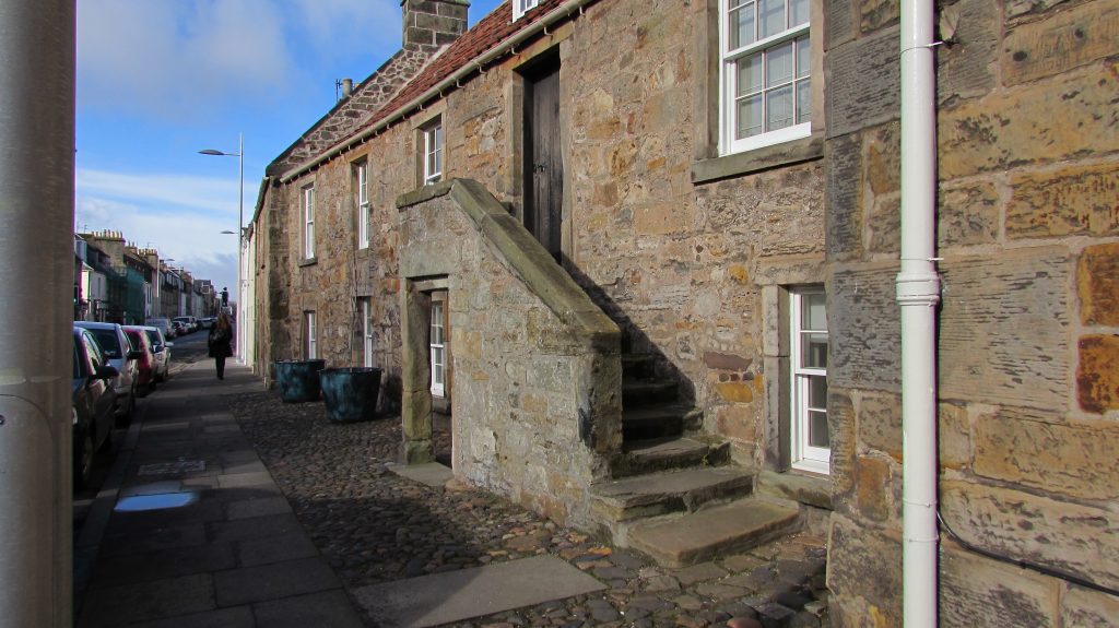
The streets to the east of the University were where the fisher folk lived. Fisher Gate, a port gate, was to the east of the Castle, and led down to the harbour. The houses would have all had external stairs to house families upstairs and below. Sometimes more than one family would share the same
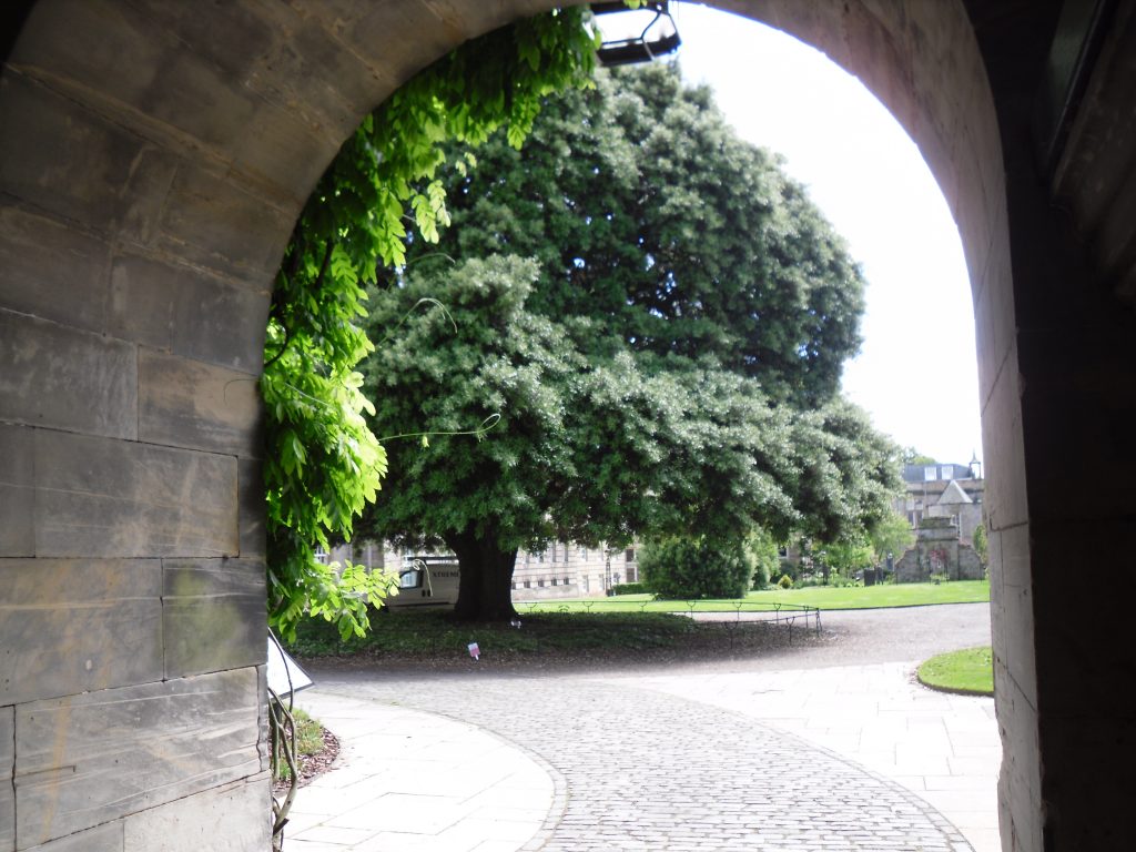
The Holm Oak was planted in the 1840s and is often mistaken as the tree planted by Mary Queen of Scots on one of her many visits to the town. The Oak is splendid throughout the year. Mary’s tree is the Hawthorn to the right outside the doors to the lecture rooms in the West Range of the School of Divinity. The Hawthorn was poorly for many years but has had a lot of support and attention over the last decade.